Interline is collaborating with HERE to demonstrate the many ways their new XYZ developer platform is useful for working with open geodata.
In these tutorials, follow along to combine together OSM Extracts by Interline, Transitland APIs, and other open geodata APIs to create unique combinations and interactive visualizations.
Use Crowdsourced Data from Interline OSM Extracts in an XYZ Web Map
Skill level: Intermediate
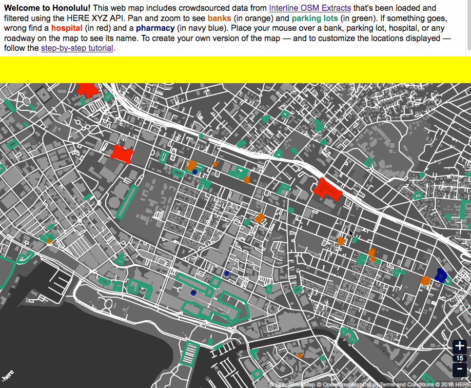
Working with OpenStreetMap extracts typically requires desktop GIS applications or libraries to filter the many different types of features included in each extract. Those steps aren't required when you're using XYZ. Filter and display using just the HERE CLI and XYZ API.
Build an Interactive Web Map of Subway Stations and Routes Showing How Long You'll Typically Wait
Skill level: Advanced
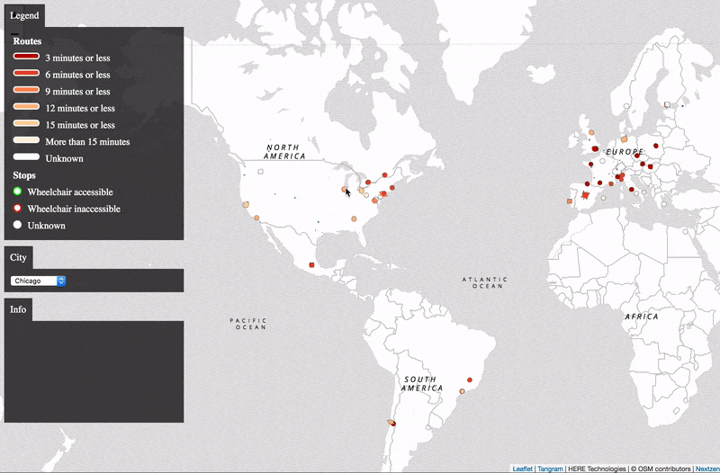
Transitland provides open public-transit data from around the world, queryable using an API. Use the HERE CLI and XYZ API to combine together many different Transitland API queries, to create a map of stop locations, route lines, and the average time you'll have to wait to travel on each.